CASE STUDIES
RFID Marking For Municipal Water Utilities
InfraMarker® RFID Project Progress
Two water utilities engaged InfraMarker to improve asset management
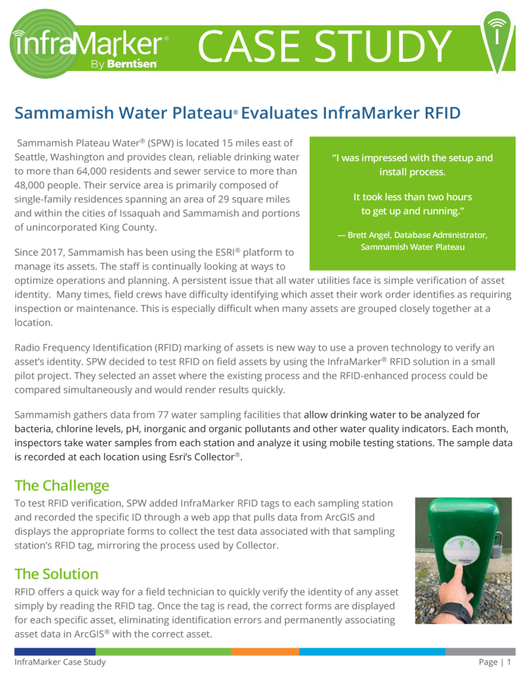
Sammamish Water Plateau
SPW uses InfraMarker RFID Web Widget for ArcGIS Online to enhance the efficiency of inspection of their water sampling facilities.
Click to download PDF
Sun Prairie Public Works
To help optimize water asset inspection and verification Sun Prairie, WI uses InfraMarker RFID Web Widget for ArcGIS Online.

Click to download PDF

Evaluation of InfraMarker RFID to Improve Accuracy in Asset Management
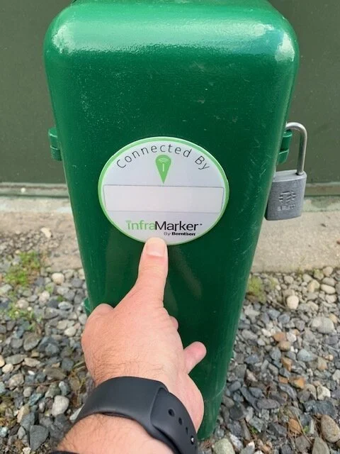
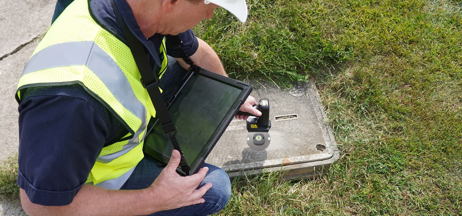
Placing an InfraMarker RFID tag on a sample station.
Many times, field crews have difficulty identifying which asset their work order identifies as requiring inspection or maintenance. This is especially difficult when many assets are grouped closely together at a location.
Sammamish Plateau Water® (SPW) is located 15 miles east of Seattle, Washington and provides clean, reliable drinking water to more than 64,000 residents and sewer service to more than 48,000 people.
Since 2017, Sammamish has been using the ESRI® platform to manage its assets. The staff is continually looking at ways to optimize operations and planning. A persistent issue that all water utilities face is simple verification of asset identity.
SPW decided to test RFID marking on field assets by using the InfraMarker RFID solution in a small pilot project. They selected an asset where the existing process and the RFID-enhanced process could be compared simultaneously and would render results quickly. Sammamish Water Plateau gathers data from 77 water sampling facilities that allow drinking water to be analyzed for bacteria, chlorine levels, pH, inorganic and organic pollutants and other water quality indicators. Each month, inspectors take water samples from each station and analyze it using mobile testing stations. The sample data is recorded at each location using Esri’s Collector®.
The challenge
To test RFID verification, SPW added InfraMarker RFID tags to each sampling station and recorded the specific ID through a web app that pulls data from ArcGIS and displays the appropriate forms to collect the test data associated with that sampling station’s RFID tag, mirroring the process used by Collector.
The Solution
RFID offers a quick way for a field technician to quickly verify the identity of any asset simply by reading the RFID tag. Once the tag is read, the correct forms are displayed for each specific asset, eliminating identification errors and permanently associating asset data in ArcGIS® with the correct asset.
“I was impressed with the setup and install process. It took less than two hours to get up and running.”
- Brett Angel, Database Administrator, Sammamish Water Plateau
Radio Frequency Identification has been used for decades to identify and track everything from parts on the manufacturing floor to library books to cars passing through toll booths.

RFID’s characteristics that include providing a unique ID for each chip, durability, affordability and versatility are the key to precise asset management.
Berntsen International, a company known for marking the infrastructure of the world, incorporated RFID into a range of marking products as well as widgets that connect RFID data to ArcGIS – a solution aptly named InfraMarker.
Berntsen’s software team used Esri’s Web AppBuilder® to create a web widget that writes and reads the RFID tag data and associates it with records in ArcGIS.
“This is great! Now, we can be confident the sample data we collect is for the correct Sample Station.”
- John Anderson, Water Superintendent, Sammamish Water Plateau
The Results
Proof of Concept – Testing RFID in a small sample to determine feasibility of large-scale deployment of the solution within SPW’s asset management environment.
This small tested demonstrated:
InfraMarker RFID eliminates the misidentification of assets
The InfraMarker web widget is easy to use for reading and writing of asset sampling data
InfraMarker extends the power of ArcGIS to the field without adding additional burden to field staff – the simple point, click, select, fill in makes data gathering more streamlined
Looking ahead
SPW plans to use the winning combination of InfraMarker and ArcGIS for their other assets as well – from pumps to sampling stations, any asset can be precisely marked with InfraMarker, then immediately connected to ArcGIS – saving time and reducing errors without burdening field staff.

Sun Prairie Evaluates InfraMarker® RFID Asset Marking
To help manage water assets in the fast-growing city, Adam Schleicher, Director of Public Works/City Engineer, engaged Berntsen to create a field trial of its InfraMarker RFID asset management solution.
The City of Sun Prairie installed a range of InfraMarker RFID markers on stormwater, sanitary sewer and water features to evaluate its feasibility in creating a connected infrastructure using Esri’s ArcGIS.
Berntsen created web widgets using Esri’s Web AppBuilder so that the RFID tag data could be associated with its specific record in ArcGIS Online.
Manholes, inlets and hydrants were all a part of the study which included more than 60 RFID markers.
InfraMarker RFID tags are designed for above or below-surface marking. Sun Prairie used the following tags:

4” round RFID markers

Fire Hydrant Marker
The Sun Prairie GIS team, led by Louis Rada, GIS and Asset Management Coordinator, headed the effort to use Web AppBuilder to customize InfraMarker’s web widgets to access asset data from ArcGIS Online .
“From installing an RFID to querying that same ID via the laser scanner was so simple and straightforward.
The City will find this process very beneficial especially where multiple assets are just feet apart.”
- Louis Rada, GIS and Asset Management Coordinator, City of Sun Prairie, Wisconsin
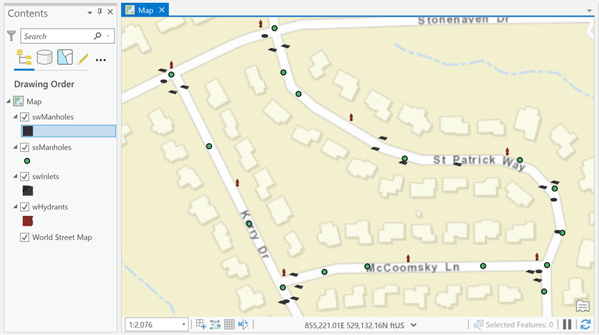
Map of InfraMarker RFID-tagged assets in Sun Prairie
Then the team added the RFID markets to each asset and wrote the asset name and type to the RFID tag using the InfraMarker RFID Write Asset Widget.
Within three hours, nearly 60 RFID tags were installed and labeled by a team of two.
About a week later, Lou completed a walk-through to test the Read Asset widget. A connection with the windows server program was established and connected the windows tablet to a cell phone to access the internet. As he walked from asset to asset, Lou was able to scan the asset and view the inspection form for each asset in the Smart Editor tool.
To date, this on-going evaluation demonstrated the feasibility and benefit of using RFID marking to tie field assets to ArcGIS through using web widgets created with Esri’s Web AppBuilder.
Stay tuned for more updates to the Sun Prairie project!