
InfraMarker RFID Industry Solutions
InfraMarker RFID is a versatile, scalable solution to support for Life Cycle Asset Management and Field Operations Management.
Visual inspection combined with connected asset management is the answer.
RFID asset marking, combined with GIS, asset marking improves the reliability and performance of many asset tracking workflows. It is an enterprise supporting solution that works scales with GIS to scale to support future your asset management goals.
-

Streamlining and Simplifying Public Works Asset Management
Cities manage thousands of assets which must be identified, tracked, inspected, maintained, and audited. InfraMarker has the RFID marking products designed for these infrastructure assets and the connecting RFID software to enhance current ESRI field data collection operations.
-

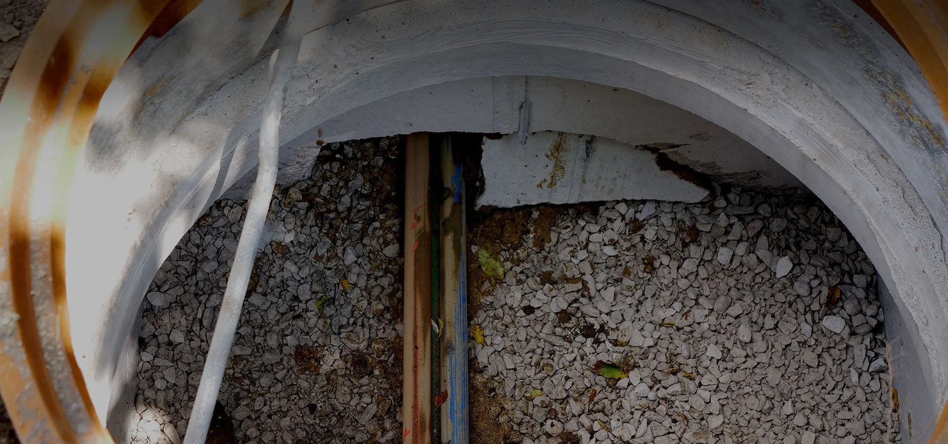
Beyond Locating - Subsurface Utility Asset Management
Underground utilities are located using traditional means such as GPR, tracer wire, or magnetic signal but it is the discrete underground points - valves, splices, weld points, fusions, conflicts, bends, abandoned sites - that require precise identification for emergency access or ongoing inspection and maintenance. InfraMarker has the underground RFID marking products for pinpoint identification and the ArcGIS enhancing software to link that underground asset with the related GIS record.
-

Other Applications for RFID Asset Management
The InfraMarker RFID solution supports a reliable two-factor asset verification system for many RFID to GIS applications. A few samples are listed below:
Cemeteries requiring absolute certainty for gravesite location and identification.
Urban tree assets that require reliable identification for treatment and maintenance.
Artifacts demanding geolocating from discovery through to storage to display.
See how InfraMarker works with the following utilities :
Fiber | Public Works | Oil & Gas | Water | Other
Fiber
Rapid deployment of 4G and 5G is increasing the need to know where fiber assets are located. Verified location of buried fiber assets prevent excavation damages and streamlines future maintenance and repairs.
47% of all excavation damage is to telecom/CATV utilities.*
Why?
Traditional methods (flags and paint) of marking and locating fiber assets can be temporary, inaccurate, or incomplete. InfraMarker Connected RFID means that buried fiber assets can be located using GIS and verified in the field with InfraMarker RFID.
Connected RFID can protect costly fiber assets and streamline future management of those assets.
2022 Dirt Report
*Forty-seven percent of reported damages to all utilities in substantially reporting states in the 2022 DIRT Report were to telecom/CATV, according to the graphic on page 9 (Common Ground Alliance).
Navigate to other owner focused utilities :
Fiber | Public Works | Oil & Gas | Water | Other

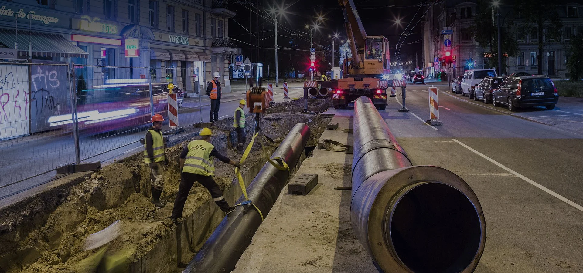
Public Works
Safeguarding the public while providing cost-effective essential services is a challenge.
Managing the underground infrastructure in a municipality is particularly challenging.
Construction and maintenance disrupt daily life, and accidental infrastructure damage can threaten lives and delay projects. “Simple” locating of underground utilities can prove to be costly and difficult.
InfraMarker leverages GIS and RFID to resolve issues associated with the accurate locating of assets (above and underground) while streamlining asset management in real-time.
InfraMarker’s two-step verification eliminates the guesswork related to locating and identifying assets in the field. Any asset (from buried water valves to trees) can be marked and connected to GIS. Later, when it’s time for field maintenance or inspection, a quick scan of the RFID tag will verify the asset, then launch the defined workflow. No guesswork, no wasted time.
InfraMarker can be used across the organization - anywhere GIS is used (or could be used) to manage assets.
Navigate to other owner focused utilities :
Fiber | Public Works | Oil & Gas | Water | Other
Oil & Gas
The industry faces continual change, including increasing pressure for speed, safety and cost efficiency.
Two-step RFID verification of gas and oil assets saves time, enhances safety and supports regulatory compliance.
InfraMarker delivers

Faster asset location in the field
When responding to emergencies or doing routine work, InfraMarker gives field technicians a faster and easier way to locate and verify assets anywhere.

Easy, intuitive on-site use
A simple scan connects the asset to GIS, launching the prescribed workflow.

Real-time integration between the field and office
Field work is captured in GIS as it occurs, providing actionable data for asset managers in real time.

Easy export to your GIS
InfraMarker is designed to provide the benefits of RFID asset verification with a wide range of GIS platforms - or even provide data if no GIS is used.

Above and below ground asset marking
No matter where or what your asset portfolio contains, InfraMarker RFID can provide the benefits of streamlined locating and management.

Automatically generated audit data
Any time an InfraMarker RFID tag is interrogated, the who, what and where is captured in GIS for TVC compliance.
See how InfraMarker works with the following utilities :
Fiber | Public Works | Oil & Gas | Water | Other

Water
Water
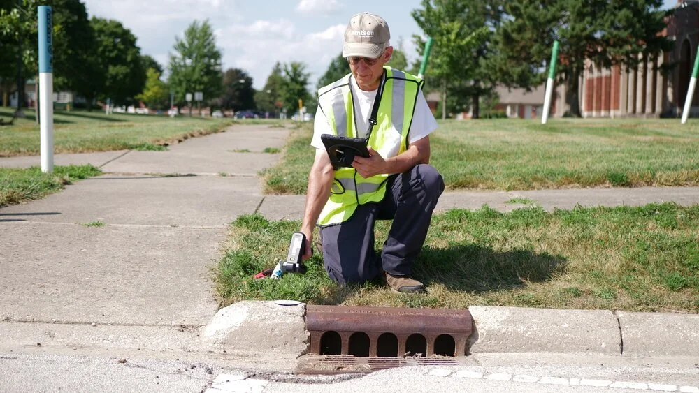
Utilities are leading innovative approaches to water resources management.
GIS-based asset management systems have greatly improved operations and management, yet the disconnect between GIS and reality in the field remains problematic.
Field crews routinely have trouble locating specific assets due to inaccurate or incomplete GIS data, wasting crew time and causing unnecessary delays. RFID two-step verification of field assets eliminates guesswork and streamlines existing workflows.
Verification and accuracy is essential when meeting MS4 requirements for stormwater assets, and InfraMarker Connected RFID delivers that assurance.
See how Sammamish Plateau Water uses InfraMarker RFID to track water sampling stations

Navigate to other owner focused utilities :
Fiber | Public Works | Oil & Gas | Water | Other
Other
The simplest solution is always the best - 14th-century logician and theologian William of Ockham.
If GIS is used (or could be used) to manage any item, then InfraMarker RFID can create a digital-to-item connection. RFID is simple and has been used for decades for tracking purposes. Now, when combined with GIS, RFID’s inherent simplicity becomes powerful. From trees to cows to tools to infrastructure, RFID ties the verified item to its specific data in GIS.
RFID Makes GIS real.
RFID markers come in all shapes and sizes and can be attached to (or near) just about anything. No line of sight is required.
A few of the items that are managed by GIS + InfraMarker RFID:
Hydrants
Water sampling stations
Utility poles
Cattle
Trash bins
Tools
Military hardware
Underground utilities
Marking of outdoor event layouts
Have items or assets you manage or want to manage with GIS? Simply contact us to see how RFID can help.
Navigate to other owner focused utilities :
Fiber | Public Works | Oil & Gas | Water | Other