
NO MAN IS AN ISLAND - CELEBRATE GIS DAY!
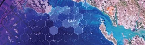
GIS means Geographic Information Systems – the technology that allows us to tell a story using data points on a map. Almost any kind of data can be added to a physical location to illustrate everything from rainfall amounts over time understanding patterns of human movement. With GIS, geography is no longer relegated to rooms filled with dusty maps.
John Donne got it right 400 years ago in an essay that includes this famous passage:

No man is an island,
entire of itself,
every man is a piece of the continent,
a part of the main.
Today, we can literally see the truth of what Donne wrote in 1623 . . . just look at The Human Reach Story Map created by Esri. Any view of the story map will illustrate the depth, beauty and power of our interconnectedness.
Today is GIS day.
GIS means Geographic Information Systems – the technology that allows us to tell a story using data points on a map. Almost any kind of data can be added to a physical location to illustrate everything from rainfall amounts over time understanding patterns of human movement. With GIS, geography is no longer relegated to rooms filled with dusty maps.
How it began
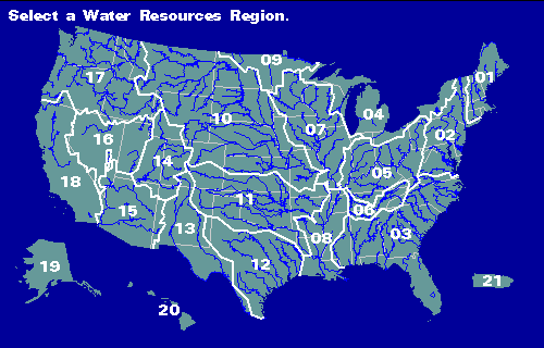
Hydrologic Unit Map from USGS
The concept of layering data over a map was first introduced by a German naturalist, Alexander von Humboldt. In 1817, he published the first isotherm map that showed the same average temperature over the globe. Before this map appeared, scientists had just assumed that average temperatures depended primarily on latitude. This map resulted in inquiries that led an understanding of how ocean currents, mountain ranges and other geography contribute to local climates.
In the 1960s, computers spurred the development of a new field of study – computational geography. In 1963, Roger Tomlinson was tasked with creating a manageable inventory of Canada’s natural resources. He realized his vision of using computers to store and process natural resource data with geographic data, and Geographic Information Systems was born. A year later, Harvard created the first computer mapping software, and in 1969, Jack and Laura Dangermond founded Environmental Systems Research Institute, Inc. (Esri).
Today, GIS gives us the tools to create our own digital maps to detect trends that can help solve problems.

3D imaging of Kilahuea Volcano, USGS
3D imaging of Kilahuea Volcano, USGS
This technology is a revelation.
We can now see what has previously been hidden, figuratively and literally. From macro problems such as climate change to locating physical structures, GIS is becoming an essential tool.
For example, during excavation, a utility contractor wants to avoid disturbing buried assets such as gas lines, electrical, water or fiber lines. GIS, combined with location data from physical markers, can reveal what lays underground – before excavation begins. Any type of asset can be marked and mapped, becoming visible and verifiable before digging begins.
InfraMarker mobile app and data management software
How’s it done?
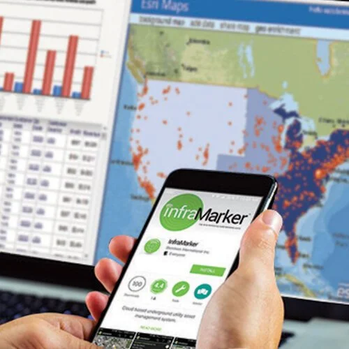
InfraMarker mobile app and data management software
Another common technology, Radio Frequency Identification (RFID) is combined with GIS to tag, identify and locate physical assets. It’s as simple as placing RFID markers on buried utilities, adding specific information about that location (a place where gas and fiber cross, for example) in a mobile app and then syncing that information with GIS.
This system, called InfraMarker®, was developed to help utilities accurately manage assets by pinning physical locations to virtually unlimited information. These pins contain specific, accurate location information that is linked to a wealth of data that is then displayed on a map – instantly viewable on a mobile app and in a GIS.
RFID markers are used in many industries for accurate tracking of inventory – and when combined with GIS, RFID provides true location intelligence – location verification and precision that can be used to improve operation workflows, reduce inspection reporting time and prevent excavation accidents. Utilities and other infrastructure owners now have a powerful, tool combines GIS accuracy with in-field location precision - making life easier for everyone dealing with infrastructure assets.
Enjoy GIS Day and imagine what GIS data could do for your utility mapping and management!
RFID Expedites Recovery
Disasters run the gamut, from environmental factors to cyber-threats to aging infrastructure. Keep in mind America receives an overall grade of D+ on the American Society of Civil Engineers Infrastructure Report Card, with the categories of drinking water, energy, and wastewater receiving a D or D+ mark.
Disasters Underscore Critical Need for Connected Utility Infrastructure
Digital Mapping Expedites Disaster Recovery, Has the Potential to Save Lives
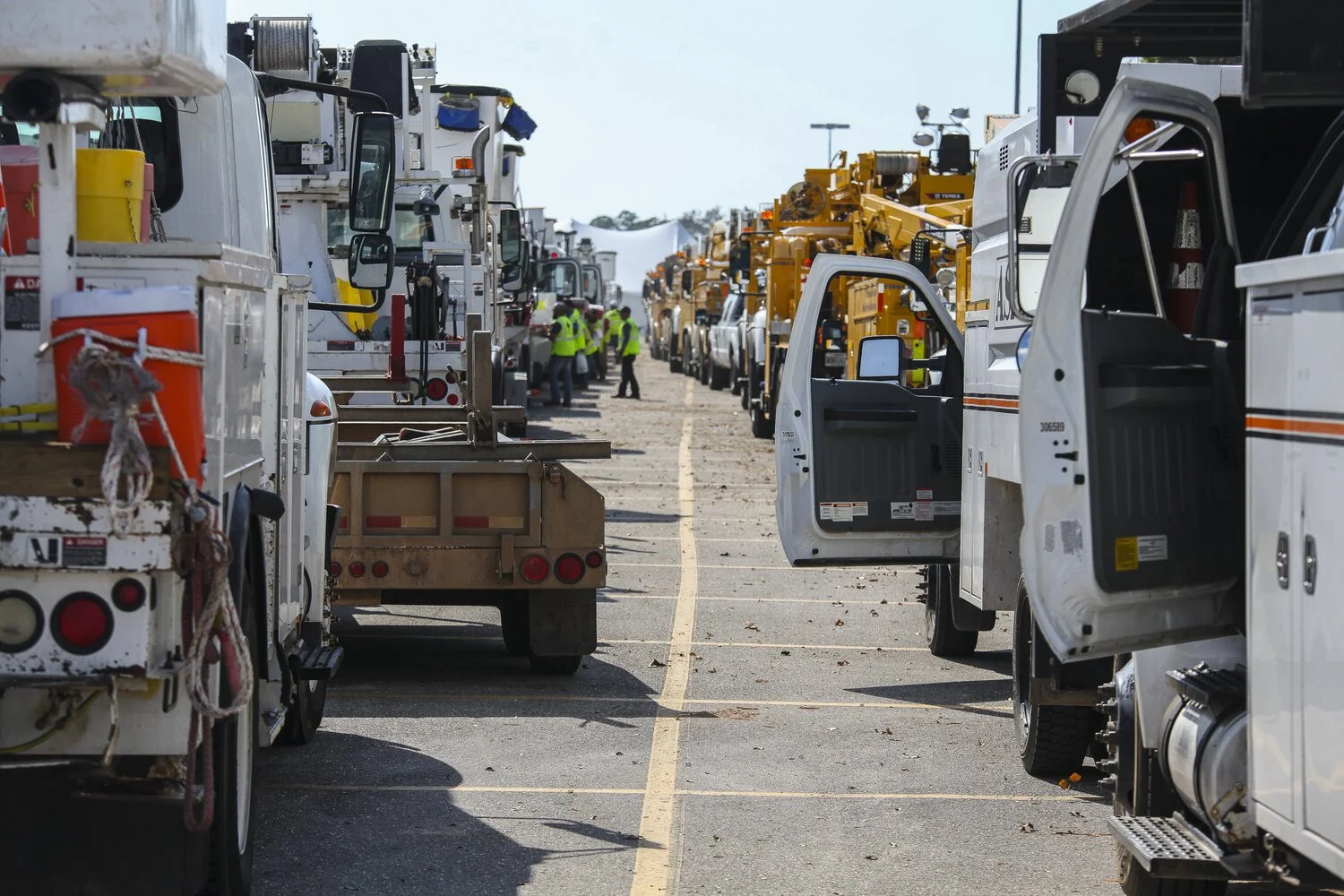
On Sept. 14, 2018, Hurricane Florence slammed into the Carolinas, bringing with her powerful winds, torrential rains and the potential to wreak catastrophic destruction. Though Florence was downgraded to a Category 1 storm as it moved over land, its high winds and rain toppled trees, triggered massive flooding and caused power transformers to explode like fireworks, leaving hundreds of thousands of people without power. More than 40 people have died as a result of the storm and flooding.
A day earlier, 800 miles up the East Coast, another disaster had occurred. Dozens of rapid-fire gas explosions caused 70 home fires and one fatality in what one official described as “Armageddon.” Entire neighborhoods north of Boston were forced to evacuate, and firefighters and crews scrambled to fight the flames and shut off the gas and electricity to the affected areas. The fires were caused when too much natural gas was pumped into a section of pipe and then leaked into homes.


These disasters—and others including the California wildfires and Hurricanes Harvey and Irma—are a cogent reminder of the critical need to upgrade and digitize our utility infrastructure. This is especially relevant for all of us at Berntsen who live and work in Wisconsin, where a massive explosion destroyed a city block in downtown Sun Prairie and killed a volunteer firefighter in July. The fact that we design equipment that might have prevented this disaster and so many others saddens us, and this tragedy has deeply affected our employees.
Disasters on the Rise

Disasters run the gamut, from environmental factors to cyber-threats to aging infrastructure. Keep in mind America receives an overall grade of D+ on the American Society of Civil Engineers Infrastructure Report Card, with the categories of drinking water, energy, and wastewater receiving a D or D+ mark.
A 2017 report prepared by Johns Hopkins University notes that the U.S. insurance industry has identified a $20 to $55 billion annual financial loss from power outages caused by flooding, hurricanes, and extreme temperatures. A combination of “higher average global temperatures, more destructive storms, and hurricanes, and increased risk of wildfire will ultimately worsen risk exposure for utilities,” the report states.
Many public and private utilities have state-of-the-art asset management systems to tackle the challenge of disasters, but the widespread deployment of these systems is lacking in much of the country, putting communities and citizens at greater risk. Over time, failure to adopt digital technologies will lead to slower disaster recovery times, potentially greater loss of life and bigger financial losses to business and the public.
“Over time, failure to adopt digital technologies will lead to slower disaster recovery times, potentially greater loss of life and bigger financial losses to business and the public. ”
The good news is digital transformation is coming to the utility industry and innovative technologies already exist to improve disaster planning, response, recovery, and underground asset management.
Connected Marking and Digital Mapping Are a Game Changer

Disasters such as storms, wildfires, explosions, and earthquakes often require gas, water, electric and telecommunications companies to quickly identify, locate and access underground utility assets.
In August 2017, a major fiber network outage in Atlantic Canada shut down cellphone and Internet service, closed some bank branches and delayed flights at multiple airports. The problem was caused when two fiber optics lines were cut during construction work.
The ability to quickly locate and repair underground utility assets is often hampered by outdated maps and inaccurate data. During a disaster, these delays can be devastating and deadly.
Connected marking solutions for utility infrastructure such as the InfraMarker® system from Berntsen International are a game changer for asset management and extremely helpful in disaster recovery. In a disaster, utility crews can use the InfraMarker mobile app and digital mapping software to quickly find the exact location of a gas pipeline shut-off valve to prevent an explosion. It’s that powerful.
This unique combination of RFID, mobile app and digital mapping software significantly expedites underground utility locating.
InfraMarker is a secure and easy way to collect and relay essential utility asset data. From there, the data can be accessed on smartphones and by popular GIS systems such as ArcGIS. Going forward, connected marking solutions will play an integral role in Smart City utility asset management.

In the past, the most important part of infrastructure management was to locate the asset. Today, infrastructure management requirements are greater and more complex. Location and other relevant data need to be available to multiple users faster—ideally in real-time—and to be integrated with GIS, ERP, workflow management and regulatory/compliance systems.
RFID is a highly effective tool for precision locating. But the key advantage of connected marking is the ability to collect, store and share asset data via the cloud. This next-gen innovation delivers exceptional benefits and ROI to utility asset managers, emergency responders, and citizens, and also has the potential to save lives.