
RFID Expedities Recovery
Disasters run the gamut, from environmental factors to cyber-threats to aging infrastructure. Keep in mind America receives an overall grade of D+ on the American Society of Civil Engineers Infrastructure Report Card, with the categories of drinking water, energy, and wastewater receiving a D or D+ mark.
Disasters underscore critical need for connected utility infrastructure
Digital mapping expedites disaster recovery, has the potential to save lives
On Sept. 14, 2018, Hurricane Florence slammed into the Carolinas, bringing with her powerful winds, torrential rains and the potential to wreak catastrophic destruction. Though Florence was downgraded to a Category 1 storm as it moved over land, its high winds and rain toppled trees, triggered massive flooding and caused power transformers to explode like fireworks, leaving hundreds of thousands of people without power. More than 40 people have died as a result of the storm and flooding.
A day earlier, 800 miles up the East Coast, another disaster had occurred. Dozens of rapid-fire gas explosions caused 70 home fires and one fatality in what one official described as “Armageddon.” Entire neighborhoods north of Boston were forced to evacuate, and firefighters and crews scrambled to fight the flames and shut off the gas and electricity to the affected areas. The fires were caused when too much natural gas was pumped into a section of pipe and then leaked into homes.
These disasters—and others including the California wildfires and Hurricanes Harvey and Irma—are a cogent reminder of the critical need to upgrade and digitize our utility infrastructure. This is especially relevant for all of us at Berntsen who live and work in Wisconsin, where a massive explosion destroyed a city block in downtown Sun Prairie and killed a volunteer firefighter in July. The fact that we design equipment that might have prevented this disaster and so many others saddens us, and this tragedy has deeply affected our employees.
Disasters on the rise
Disasters run the gamut, from environmental factors to cyber-threats to aging infrastructure. Keep in mind America receives an overall grade of D+ on the American Society of Civil Engineers Infrastructure Report Card, with the categories of drinking water, energy, and wastewater receiving a D or D+ mark.
A 2017 report prepared by Johns Hopkins University notes that the U.S. insurance industry has identified a $20 to $55 billion annual financial loss from power outages caused by flooding, hurricanes, and extreme temperatures. A combination of “higher average global temperatures, more destructive storms, and hurricanes, and increased risk of wildfire will ultimately worsen risk exposure for utilities,” the report states.
Many public and private utilities have state-of-the-art asset management systems to tackle the challenge of disasters, but the widespread deployment of these systems is lacking in much of the country, putting communities and citizens at greater risk. Over time, failure to adopt digital technologies will lead to slower disaster recovery times, potentially greater loss of life and bigger financial losses to business and the public.
The good news is digital transformation is coming to the utility industry and innovative technologies already exist to improve disaster planning, response, recovery, and underground asset management.
Connected marking and digital mapping are a game changer
Disasters such as storms, wildfires, explosions, and earthquakes often require gas, water, electric and telecommunications companies to quickly identify, locate and access underground utility assets.
In August 2017, a major fiber network outage in Atlantic Canada shut down cellphone and Internet service, closed some bank branches and delayed flights at multiple airports. The problem was caused when two fiber optics lines were cut during construction work.
The ability to quickly locate and repair underground utility assets is often hampered by outdated maps and inaccurate data. During a disaster, these delays can be devastating and deadly.
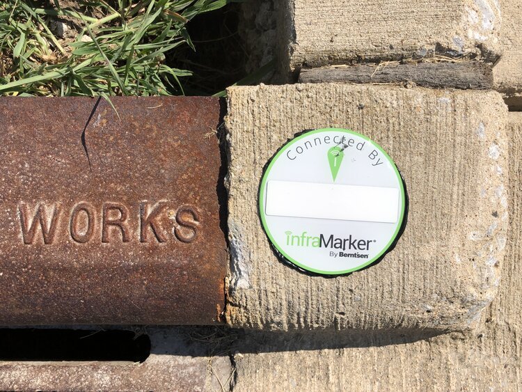
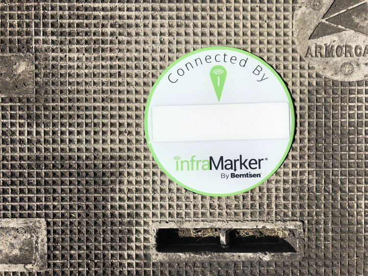
Connected marking solutions for utility infrastructure such as the InfraMarker® system from Berntsen International are a game changer for asset management and extremely helpful in disaster recovery. In a disaster, utility crews can use the InfraMarker mobile app and digital mapping software to quickly find the exact location of a gas pipeline shut-off valve to prevent an explosion. It’s that powerful.
This unique combination of RFID, mobile app and digital mapping software significantly expedites underground utility locating.
InfraMarker is a secure and easy way to collect and relay essential utility asset data. From there, the data can be accessed on smartphones and by popular GIS systems such as ArcGIS. Going forward, connected marking solutions will play an integral role in Smart City utility asset management.
In the past, the most important part of infrastructure management was to locate the asset. Today, infrastructure management requirements are greater and more complex. Location and other relevant data need to be available to multiple users faster—ideally in real-time—and to be integrated with GIS, ERP, workflow management and regulatory/compliance systems.
RFID is a highly effective tool for precision locating. But the key advantage of connected marking is the ability to collect, store and share asset data via the cloud. This next-gen innovation delivers exceptional benefits and ROI to utility asset managers, emergency responders, and citizens, and also has the potential to save lives.

Image credit: FEMA - Utility Trucks and Crews Line up To Help

Image credit: Wisconsin State Journal
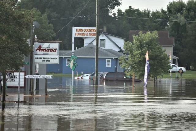
Image credit: US Army
Over time, failure to adopt digital technologies will lead to slower disaster recovery times, potentially greater loss of life and bigger financial losses to business and the public.

INSTALLATION PREPARATION
InfraMarker uses a 3-level approach for geo-data management. Data added to the tag stores information related to the asset, including the tag position relative to the asset.
Field data collection verifies the tag’s position relative to other above-ground assets (such as a photo of asset [or the asset revealed by excavation], or videos of the surrounding terrain to assist in relocating the asset) and can include comments related to the installation or reading of that tag.
Equipment and preparation needed to install, locate, and map InfraMarker®
InfraMarker uses a 3-level approach for geo-data management. Data added to the tag stores information related to the asset, including the tag position relative to the asset.
Field data collection verifies the tag’s position relative to other above-ground assets (such as a photo of asset [or the asset revealed by excavation], or videos of the surrounding terrain to assist in relocating the asset) and can include comments related to the installation or reading of that tag.
Data added by the administrator is appended to the record and may include customer specific information, historical records or other documents related to that asset.
INFRAMARKER TAGS
InfraMarker tags are standard Class 1, Gen 2 RFID tags that have been tested and approved by InfraMarker for use in infrastructure management applications. The InfraMarker tags are provided to the customer with a standard data schema that works with InfraMarker software.
The standard data schema is set up as follows:
Asset Owner
Asset Type
Asset Function
Asset Material
Asset Feature
Latitude
Longitude
Tag Install Date/Time stamp
Depth from Surface to Asset
Offset Direction & Distance
TWO TYPES OF INFRAMARKER TAGS ARE AVAILABLE
InfraMarker-enabled underground markers that include an RFID tag, magnet, and steel backing. These tags are the IM483B, IM362B, IM221B , and IMDEEP 1.
InfraMarker-enabled above ground marking products including customizeable label for catch basin, curb marking or other applications where a label is required. In addition, the fire hydrant marker is available and can be used on metal hydrants or utility poles.
APP DATA RECORD
The InfraMarker record is contained in the app and uploaded to your GIS or the InfraMarker Cloud in the following format:
Tag information
Handheld data information
Mobile Device ID
User ID from Mobile Device
Date/Time Stamp of read
Comments [recommended to communicate information about the tag position relative to other landmarks or important information related to above ground location].
CLOUD RECORD
Every app record from every InfraMarker tag is uploaded to your GIS system or the InfraMarker cloud. This record can be appended by the customer with information specific their asset management needs.
INFRAMARKER WEBSITE
The InfraMarker website collects registration information, controls user access for download and display, links to InfraMarker training and support material, and offers the customer the ability to purchase InfraMarker related marking products and support.
RFID SCANNER
InfraMarker’s lightweight Bluetooth® UHF RFID readers are capable of reading and writing to tags directly from a Bluetooth-enabled mobile device. Equipped with a powerful Impinj R2000 core and range of interchangeable high-performance antennas, it delivers reliable reads even in difficult or deep placements.