
NO MAN IS AN ISLAND - CELEBRATE GIS DAY!
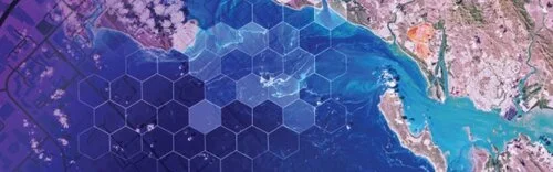
GIS means Geographic Information Systems – the technology that allows us to tell a story using data points on a map. Almost any kind of data can be added to a physical location to illustrate everything from rainfall amounts over time understanding patterns of human movement. With GIS, geography is no longer relegated to rooms filled with dusty maps.
John Donne got it right 400 years ago in an essay that includes this famous passage:

No man is an island,
entire of itself,
every man is a piece of the continent,
a part of the main.
Today, we can literally see the truth of what Donne wrote in 1623 . . . just look at The Human Reach Story Map created by Esri. Any view of the story map will illustrate the depth, beauty and power of our interconnectedness.
Today is GIS day.
GIS means Geographic Information Systems – the technology that allows us to tell a story using data points on a map. Almost any kind of data can be added to a physical location to illustrate everything from rainfall amounts over time understanding patterns of human movement. With GIS, geography is no longer relegated to rooms filled with dusty maps.
How it began
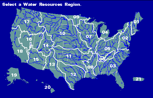
Hydrologic Unit Map from USGS
The concept of layering data over a map was first introduced by a German naturalist, Alexander von Humboldt. In 1817, he published the first isotherm map that showed the same average temperature over the globe. Before this map appeared, scientists had just assumed that average temperatures depended primarily on latitude. This map resulted in inquiries that led an understanding of how ocean currents, mountain ranges and other geography contribute to local climates.
In the 1960s, computers spurred the development of a new field of study – computational geography. In 1963, Roger Tomlinson was tasked with creating a manageable inventory of Canada’s natural resources. He realized his vision of using computers to store and process natural resource data with geographic data, and Geographic Information Systems was born. A year later, Harvard created the first computer mapping software, and in 1969, Jack and Laura Dangermond founded Environmental Systems Research Institute, Inc. (Esri).
Today, GIS gives us the tools to create our own digital maps to detect trends that can help solve problems.

3D imaging of Kilahuea Volcano, USGS
3D imaging of Kilahuea Volcano, USGS
This technology is a revelation.
We can now see what has previously been hidden, figuratively and literally. From macro problems such as climate change to locating physical structures, GIS is becoming an essential tool.
For example, during excavation, a utility contractor wants to avoid disturbing buried assets such as gas lines, electrical, water or fiber lines. GIS, combined with location data from physical markers, can reveal what lays underground – before excavation begins. Any type of asset can be marked and mapped, becoming visible and verifiable before digging begins.
InfraMarker mobile app and data management software
How’s it done?
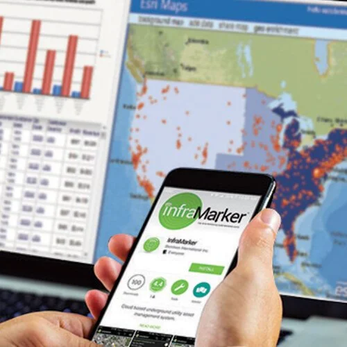
InfraMarker mobile app and data management software
Another common technology, Radio Frequency Identification (RFID) is combined with GIS to tag, identify and locate physical assets. It’s as simple as placing RFID markers on buried utilities, adding specific information about that location (a place where gas and fiber cross, for example) in a mobile app and then syncing that information with GIS.
This system, called InfraMarker®, was developed to help utilities accurately manage assets by pinning physical locations to virtually unlimited information. These pins contain specific, accurate location information that is linked to a wealth of data that is then displayed on a map – instantly viewable on a mobile app and in a GIS.
RFID markers are used in many industries for accurate tracking of inventory – and when combined with GIS, RFID provides true location intelligence – location verification and precision that can be used to improve operation workflows, reduce inspection reporting time and prevent excavation accidents. Utilities and other infrastructure owners now have a powerful, tool combines GIS accuracy with in-field location precision - making life easier for everyone dealing with infrastructure assets.
Enjoy GIS Day and imagine what GIS data could do for your utility mapping and management!

DISASTER RECOVERY
A solution to locating buried assets is now available. A combination of radio frequency identification (RFID), magnetic locating and GPS technology has proven to be an effective solution. The InfraMarker solution uses these proven technologies to make locating fast and accurate.
Improving Disaster Recovery Efficiency with RFID/GPS Technology
Whether natural or accidental, wide-scale damage to above ground structures and terrain can make the task of subsurface utility recovery and maintenance difficult and expensive. The difficulty is compounded when using dated technology and traditional mapping methods.
Investing in new solutions to underground asset recovery can save money and improve overall utility system efficiency.
Circumventing traditional post-disaster asset locating issues
One of the most significant issues facing utility companies after a disaster is locating buried assets. Traditional mapping and field techniques often use geographic landmarks to position assets relative to one another. If the disaster destroys landmarks, a larger area must be excavated to uncover the buried assets. This process is expensive and can threaten nearby utilities included in the expanded excavation area.
These issues become even more complex when multiple utility agencies are involved in recovery efforts. In most cases, both public and private entities work simultaneously to assess, service or recover utility assets in close proximity to one another. Miscommunication and poor planning ahead of time can result in further complications and operational delays.
A solution with RFID and GPS integration
A solution to locating buried assets is now available. A combination of radio frequency identification (RFID), magnetic locating and GPS technology has proven to be an effective solution. The InfraMarker solution uses these proven technologies to make locating fast and accurate.
Researchers at the Geospatial Research and Applications Center (GRAC) at Auburn University conducted a study on this approach in a disaster recovery scenario.
Researchers concluded the InfraMarker solution improved overall efficiency when it came to finding buried assets under stressful conditions.
Specifically, RFID/GPS mapping systems present a solution for utility companies using hardware such as cable tracers to locate and identify buried assets. While tracer pedestals often damaged or destroyed during disasters, RFID tags are constructed specifically to withstand adverse weather and long-term deployment underground.
When the RFID tagging infrastructure is fully implemented, positioning information from the InfraMarker can be used to generate precise, expansive digital mapping tools for excavating – and is especially useful in disaster recovery efforts.